arcus
arc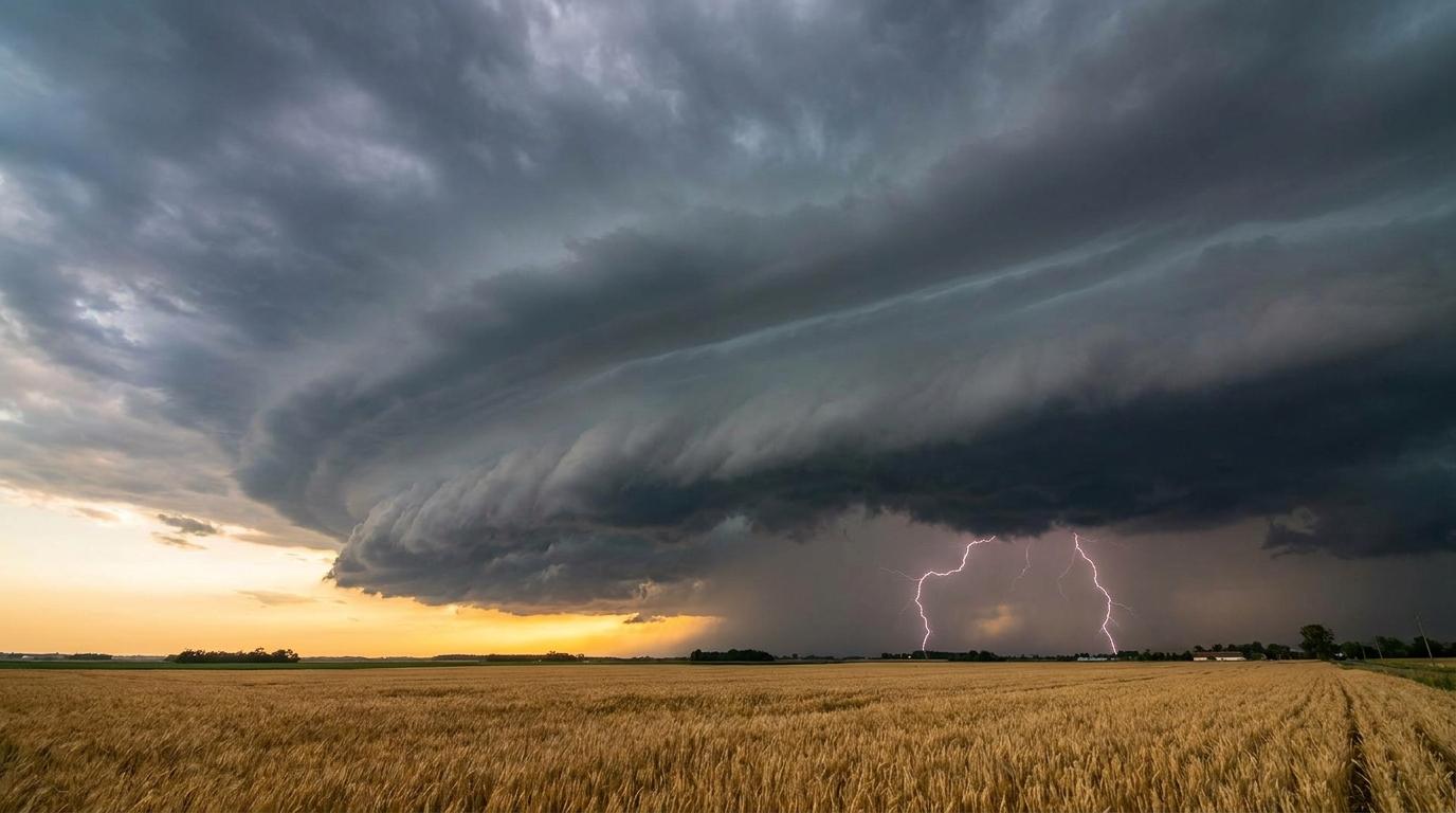
Cumulonimbus arcus
© wetterkurs.ch
Description
The name "arcus" (Latin for arch) describes a striking, arch- or roll-shaped cloud formation at the leading edge of a thunderstorm cell or squall line. Arcus is an accessory cloud that occurs primarily with cumulonimbus, and occasionally with vigorous cumulus. It forms when the cold downburst outflow of a thunderstorm lifts the warm, moist air ahead of it, forcing condensation. It appears particularly impressive as a so-called roll cloud or as a jagged shelf cloud directly at the updraft region of the thunderstorm.
Identification Features
- Dark, horizontal cloud roll or arch-shaped front
- Located at the leading edge of an approaching thunderstorm cell
- Often sharply defined, smooth base with a ragged upper edge
- Can extend horizontally over several kilometres
- Accompanied by suddenly intensifying, cold gusts
- Menacing appearance, often lead-grey to blue-black in colour
- Frequently occurs in association with cumulonimbus arcus
Related genera
arcus is not a distinct cloud type, but a supplementary feature that is given in addition to the genus name. It can occur with the following genera: Cu, Cb.
Meteorological Significance
Arcus is a clear warning sign of imminent severe weather. Its passage is associated with strong to stormy gusts, an abrupt drop in temperature, and the onset of heavy rain or hail. The cloud marks the boundary between the warm air ahead of the storm and the cold downdraft air of the thunderstorm. For aviation and outdoor activities (shipping, construction, events), it is an important visual alarm signal. Its passage is typically followed by intense precipitation accompanied by electrical activity.
Facts
- WMO-Code
- arc
- Height layer
- Vertical clouds
- Typical height
- 0.2 - 1.5 km
- Genus
- CUMULONIMBUS