cauda
cauda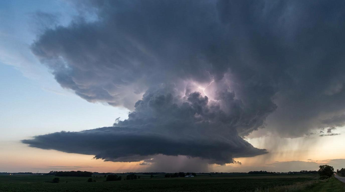
Cumulonimbus cauda
© wetterkurs.ch
Description
The name "cauda" (Latin for tail) describes a tail-like, horizontal cloud formation that extends from a murus cloud (wall cloud) of a supercell thunderstorm toward the main precipitation area. The cauda is an accessory cloud and was only officially added to the WMO's International Cloud Atlas in 2017. It forms from moist, cool air that is drawn from the precipitation area into the updraft region of the supercell. Visually, it resembles a tail or rat's tail that attaches laterally to the wall cloud, and it generally moves in the direction of the rotating updraft base.
Identification Features
- Horizontal, tail-like cloud at low level
- Connects the murus (wall cloud) to the precipitation area of a supercell
- Moves toward the rotating updraft base
- Occurs exclusively in association with cumulonimbus supercells
- Appears as a flat, elongated tail or strand
- Often accompanied by scud clouds (fractus) beneath it
- Typically visible on the rear or flank of the thunderstorm
Related genera
cauda is not a distinct cloud type, but a supplementary feature that is given in addition to the genus name. It can occur with the following genera: Cb.
Meteorological Significance
The cauda is a clear indicator of an organized supercell with strong rotation, and therefore of an elevated severe weather potential. Its presence signals that the thunderstorm has a pronounced updraft region with moisture inflow, which increases the likelihood of large hail, storm gusts, and tornadoes. It typically occurs together with a murus and is one of the key features used by storm chasers and meteorologists for tornado warnings. In Switzerland, cauda clouds are rare, but can be observed during powerful summer thunderstorms in the Mittelland or the Alpine foothills. Anyone who spots a cauda should immediately seek shelter.
Facts
- WMO-Code
- cauda
- Height layer
- Low clouds
- Typical height
- 0.3 - 1.5 km
- Genus
- CUMULONIMBUS