murus
mur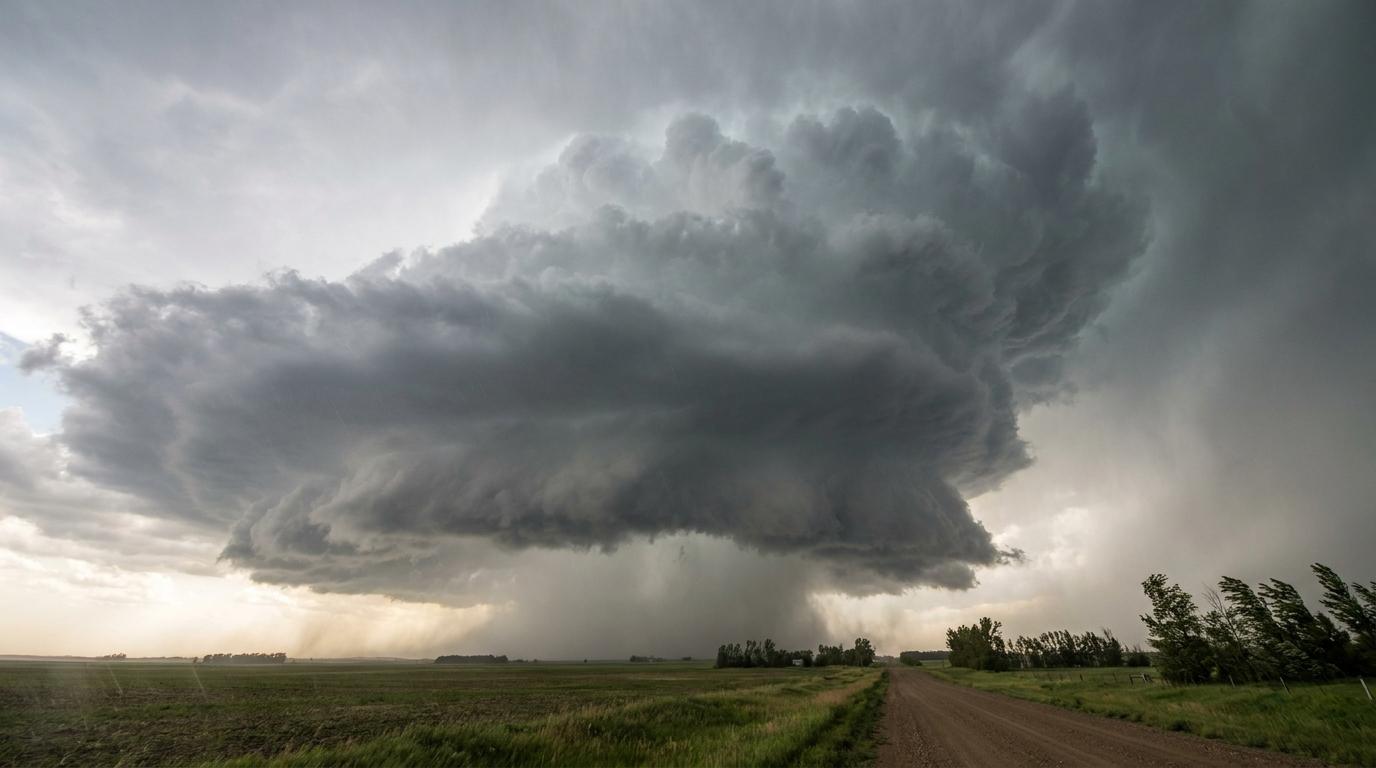
Cumulonimbus murus
© wetterkurs.ch
Description
The name «murus» (Latin: wall) describes a wall-like hanging cloud formation known as a wall cloud. Murus is a supplementary feature and appears beneath the precipitation-free base of a cumulonimbus, typically below the updraft region of a supercell. This abruptly lowered, often rotating cloud base ranges from a few hundred meters to several kilometers in diameter. It is considered a precursor to tornado formation, as a funnel cloud tube (tuba) can develop from it.
Identification Features
- Locally and strongly lowered, wall-like cloud base beneath a thunderstorm cloud
- Located in the precipitation-free portion of a cumulonimbus, near the precipitation zone
- Often visible rotation around a vertical axis
- Sharply defined, compact cloud block below the normal cloud base
- Frequently accompanied by inflowing and outflowing air at the edges
- Can produce funnel clouds (tuba) or tornadoes extending downward
- Typically occurs on the southwest or southern side of a supercell
Related genera
murus is not a distinct cloud type, but a supplementary feature that is given in addition to the genus name. It can occur with the following genera: Cb.
Meteorological Significance
Murus is one of the most important visual warning signs of severe weather and potential tornado formation. A rotating wall cloud indicates a mesocyclone within a supercell, in which tornadoes can develop. Observers should immediately seek shelter upon sighting one and should not attempt to approach it. Meteorologists use the appearance of murus to confirm radar signatures and to issue tornado warnings. Heavy rainfall, large hail, severe wind gusts, and intense lightning activity frequently occur alongside it.
Facts
- WMO-Code
- mur
- Height layer
- Vertical clouds
- Typical height
- 0.3 - 1.5 km
- Genus
- CUMULONIMBUS