Altostratus
As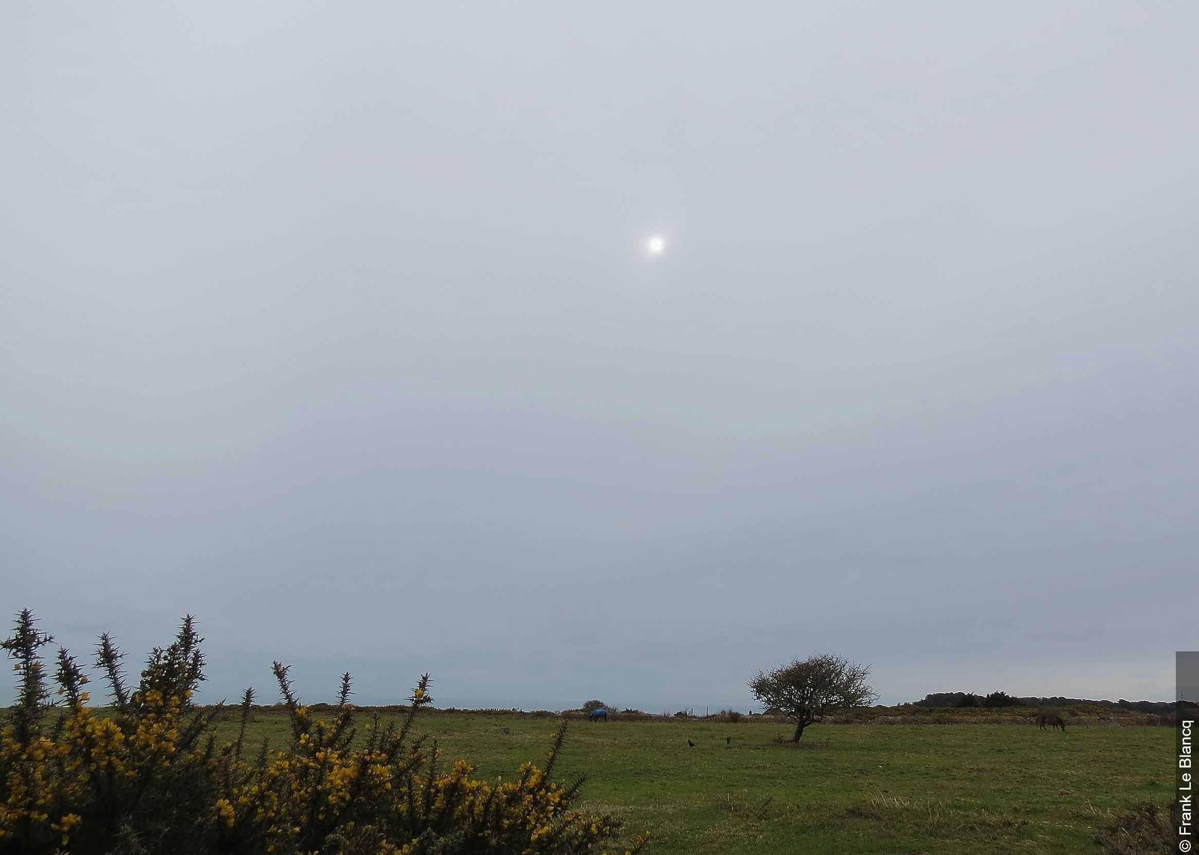
Altostratus
© Frank Le Blancq WMO
Description
Altostratus (lat. altus = high, stratus = spread out) is a gray or bluish-gray layer cloud that covers the sky extensively and often uniformly. It is thin enough to let the sun shine through like frosted glass, without any halo phenomena occurring. Altostratus consists of a mixture of water droplets and ice crystals and frequently extends over hundreds of kilometers. The cloud typically forms through large-scale, slow gliding of warm, moist air over a cold air mass, as occurs at warm fronts. As it thickens, altostratus can completely obscure the sun and transition into nimbostratus.
Identification Features
- Uniform, gray to bluish-gray cloud layer covering large portions of the sky
- The sun often still shines through diffusely, as if through frosted glass (known as the "frosted glass effect")
- No halo phenomena visible, which distinguishes altostratus from cirrostratus
- Cloud layer appears structureless or only weakly structured
- Ground shadows are faint or entirely absent when altostratus is thin
- Unlike stratus, the cloud base lies noticeably higher, in the middle levels of the atmosphere
- Can produce light precipitation (virga) that does not always reach the ground
- Becomes increasingly darker and more opaque as it thickens
Species of this genus
Highlighted: all species that occur with Altostratus.
Meteorological Significance
Altostratus is one of the most important harbingers of an approaching warm front and typically signals precipitation within the next 6 to 24 hours. It characteristically forms as the successor to cirrostratus in the classic frontal sequence, gradually thickening into nimbostratus with sustained precipitation. Light rain or snow can already fall from thicker altostratus and reach the ground. In combination with falling air pressure, altostratus is a reliable indicator of impending deteriorating weather. However, isolated, thin altostratus can also dissipate without any subsequent precipitation.
Facts
- WMO-Code
- As
- Height layer
- Mid-level clouds
- Typical height
- 2.0 - 6.0 km
- Genus
- ALTOSTRATUS