Stratocumulus lenticularis
Sc len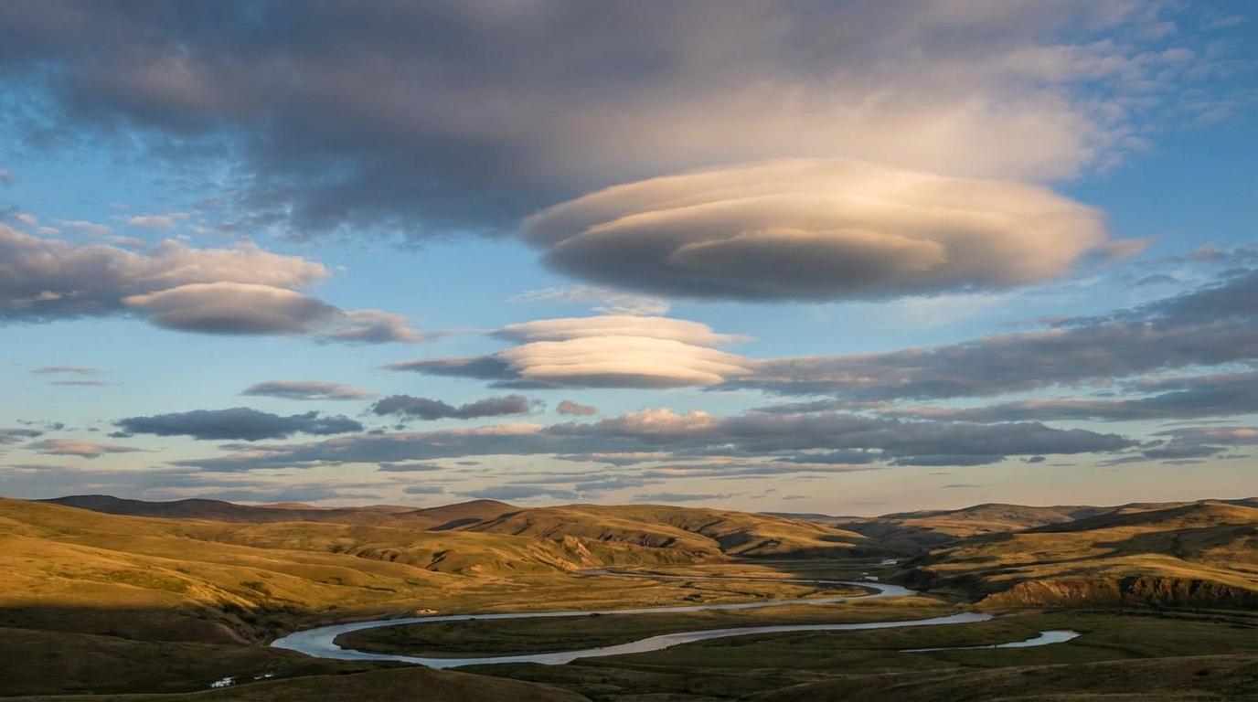
Stratocumulus lenticularis
© wetterkurs.ch
Description
The name "lenticularis" (Latin: lens-shaped) describes the characteristic smooth, lens- or almond-shaped form of this cloud. Stratocumulus lenticularis typically forms in the lee of mountains or hills, when moist air is set into wave motion by orographically forced lifting. In contrast to the more commonly observed Altocumulus lenticularis, these clouds are found in lower layers of the atmosphere, usually below 2,500 metres. They appear as individual or grouped, sharply defined cloud patches with smooth contours and an often strikingly stationary position in the sky. Despite strong upper-level winds, they seem virtually motionless, as they are continuously forming on the windward side of the wave and dissipating again on the leeward side.
Identification Features
- Smooth, lens- or almond-shaped cloud form with clearly defined edges
- Lower position in the sky than the more common Altocumulus lenticularis
- Appears stationary in one location despite wind
- Occurs preferentially near mountains, hills, or prominent terrain features
- Surface appears polished and smooth, without ragged edges
- Can occur individually or in multiple stacked layers
- Often arranged in rows parallel to the mountain ridge
- Distinguished from ordinary Stratocumulus by its isolated, symmetrical shape
Occurrence by genus
Highlighted: all genera with which lenticularis occurs.
Meteorological Significance
Stratocumulus lenticularis is a reliable indicator of strong wind currents and lee waves in the lower troposphere, triggered by orographic obstacles. These clouds are significant for aviation, as they can point to considerable turbulence and rotors at low altitudes. As a fair-weather cloud, it does not produce precipitation itself, but can indicate an approaching change in weather when it occurs together with lenticularis clouds in the middle and upper levels. Near mountainous terrain, its presence warns pilots and paragliders of potentially dangerous updrafts and downdrafts close to the ground.
Facts
- WMO-Code
- Sc len
- Height layer
- Low clouds
- Typical height
- 0.6 - 2.0 km
- Genus
- STRATOCUMULUS