Altocumulus stratiformis
Ac str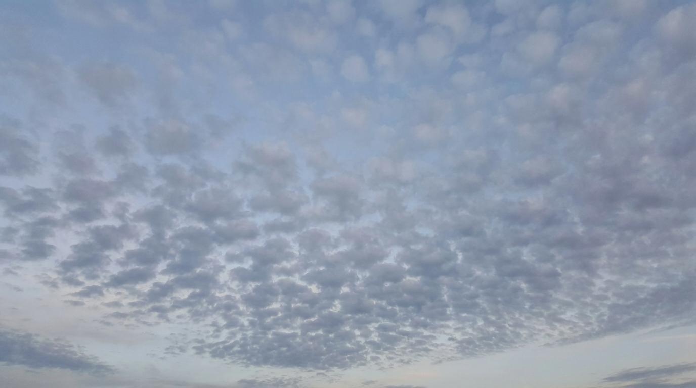
Altocumulus stratiformis
© Wetterkurs.ch
Description
The name "stratiformis" (Latin: spread out in layers) describes a species of altocumulus that extends as a broad, sheet-like cloud layer across large portions of the sky. Altocumulus stratiformis is the most common of all altocumulus species and appears as a continuous field of rounded cloud elements arranged in bands, patches, or sheets. The individual elements may lie close together or be separated by narrow gaps. This cloud form frequently covers the sky partially or completely, producing a characteristic pattern reminiscent of cobblestones or a flock of sheep. The cloud typically forms through large-scale, slow ascent of moist air at middle levels or through the spreading of convective cells.
Identification Features
- Extensive, sheet-like layer of individual rounded cloud elements at middle altitudes
- Individual elements appear as whitish to grey patches, plates, or rolls
- Regular, often chessboard-like or pavement-like pattern across the sky
- Elements have an apparent width of approximately 1 to 5 degrees (between one finger and three fingers at arm's length)
- Narrow but visible gaps are often present between the elements
- The layer may cover large portions of the sky without fully closing into a uniform grey
- Distinctly larger than cirrocumulus elements, often with visible self-shading
- No precipitation reaching the ground
Occurrence by genus
Highlighted: all genera with which stratiformis occurs.
Meteorological Significance
Altocumulus stratiformis is an important indicator of moisture in the middle tropospheric layers and can signal impending changes in weather. When this cloud appears on a warm summer morning, it is regarded as a classic sign of possible thunderstorm development in the afternoon, as it points to unstable layering in the middle atmosphere. In association with approaching frontal systems, altocumulus stratiformis can herald a warm front or occlusion, particularly when the cloud cover becomes progressively thicker. When occurring in isolation during settled weather, however, it is often harmless and dissipates over the course of the day. In rare cases, light virga (fallstreaks) may be observed, which nevertheless does not reach the ground.
Facts
- WMO-Code
- Ac str
- Height layer
- Mid-level clouds
- Typical height
- 2.0 - 6.0 km
- Genus
- ALTOCUMULUS