Stratocumulus stratiformis
Sc str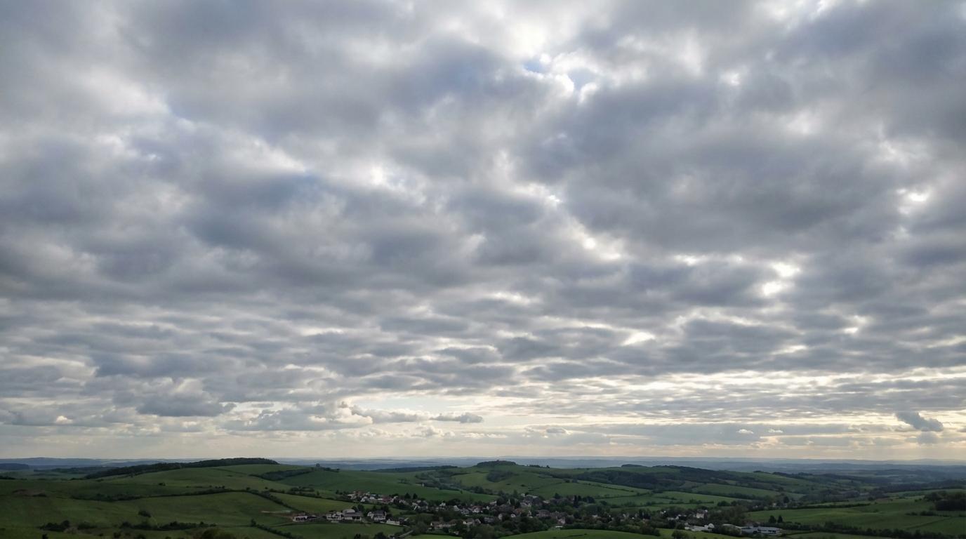
Stratocumulus stratiformis
© Wetterkurs.ch
Description
The name "stratiformis" (Latin: spread out in a layer) describes a species of stratocumulus that extends across the sky as a broad, sheet-like cloud cover. Stratocumulus stratiformis is the most common cloud form in the world, frequently covering large portions of the sky as a continuous or nearly closed layer of rounded cloud elements. The individual elements are arranged in the form of clumps, rolls, or tiles, separated by narrow gaps through which patches of blue sky are occasionally visible. This cloud form commonly develops through large-scale subsidence and a pronounced temperature inversion that limits the vertical growth of the clouds. It occurs particularly frequently in maritime climate zones and during the cooler season over land.
Identification Features
- Extensive, sheet-like cloud layer covering large portions of the sky
- Rounded, flattened cloud elements in the form of clumps, rolls, or tiles
- Narrow gaps between elements through which patches of blue sky are sometimes visible
- Grey to greyish-white in colour; the underside may show darker shading
- Relatively uniform base at low altitude
- Significantly larger cloud elements than those of altocumulus (apparent width greater than 5°)
- No significant vertical development; predominantly spread out horizontally
- Frequently observed in the morning or evening and near coastlines
Occurrence by genus
Highlighted: all genera with which stratiformis occurs.
Meteorological Significance
Stratocumulus stratiformis is generally an indicator of fair weather, or at least signals stable atmospheric conditions in the lower troposphere. This cloud layer typically produces no significant precipitation; at most, light drizzle may occur. The presence of a strong inversion layer prevents convective development, making thunderstorms very unlikely under this type of cloud cover. If the stratocumulus layer dissipates during the course of the day, cumulus clouds may develop given sufficient instability. Conversely, a thickening and lowering of the layer may indicate an approaching warm front or increasing moisture in the lower troposphere.
Facts
- WMO-Code
- Sc str
- Height layer
- Low clouds
- Typical height
- 0.6 - 2.0 km
- Genus
- STRATOCUMULUS