Cumulonimbus calvus
Cb cal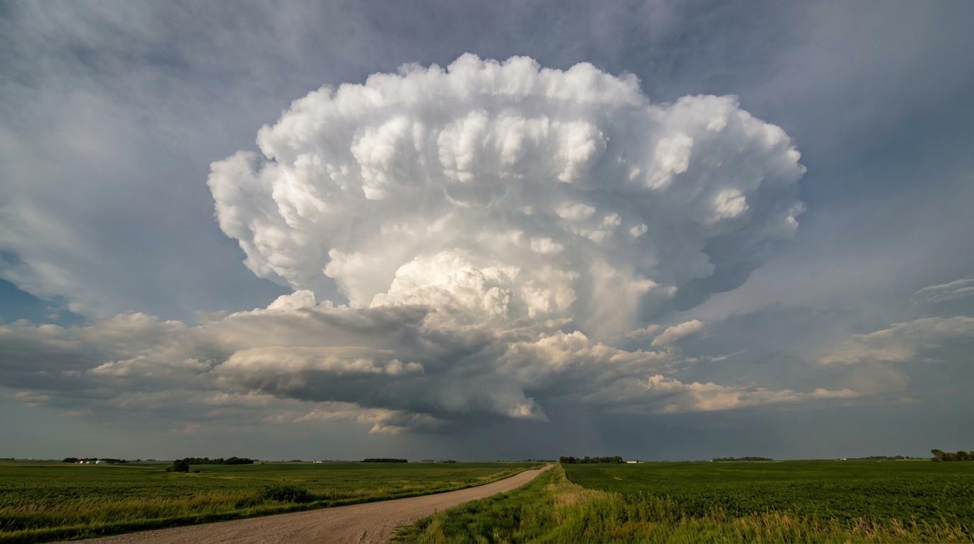
Cumulonimbus calvus
© wetterkurs.ch
Description
The name "calvus" (Latin: bald, bare-headed) describes the characteristic appearance of this cloud, in which the formerly sharply defined convective towers begin to take on a smooth, rounded, and seemingly close-cropped form at their upper portion. This occurs because the water droplets in the summit region are being converted into ice crystals, causing the sharp outlines of the Cumulus congestus to disappear, while the fibrous anvil structure of the Cumulonimbus capillatus has not yet formed. Cumulonimbus calvus thus represents a transitional stage: the cloud has already crossed the threshold into Cumulonimbus, as glaciation is beginning, yet the characteristic anvil is still absent. The vertical extent is considerable and can reach from ground level far into the upper troposphere, with the cloud potentially attaining heights of over 10 kilometres. Intense updrafts and downdrafts are already occurring within the cloud, and precipitation, lightning, and thunder may already be present.
Identification Features
- Powerful, strongly vertically developed convective cloud with a whitish, smooth or slightly fibrous upper surface
- The summit region appears "bald" and rounded, lacking the sharp, cauliflower-like outlines of a Cumulus congestus
- No pronounced anvil or fibrously spreading canopy present at the top of the cloud
- The base is dark and can lie very low, frequently with visible precipitation beneath
- Transitional stage: a soft, blurred summit indicates the onset of glaciation
- Initial lightning and thunder are often already possible
- The cloud may be accompanied by heavy rain, graupel, or small hail
- Viewed from the side, a massive, tower-like structure is visible that progressively loses definition towards the summit
Occurrence by genus
Highlighted: all genera with which calvus occurs.
Meteorological Significance
Cumulonimbus calvus is a clear indicator of a rapidly developing thunderstorm. The onset of glaciation at the cloud's upper surface signals that convective activity is strong enough to transport large quantities of water to great heights, where freezing processes begin. Further development into Cumulonimbus capillatus with a pronounced anvil is to be expected shortly, indicating increasingly severe weather phenomena such as heavy rain, hail, storm-force gusts, and intense lightning activity. Pilots avoid these clouds due to extreme turbulence, severe icing, and the risk of hail. For surface stations, the appearance of a Cumulonimbus calvus means that a fully developed thunderstorm can be expected within minutes to a few hours.
| Genera: | Altocumulus AcAltostratus AsCirrocumulus CcCirrostratus CsCirrus CiCumulonimbus CbCumulus CuNimbostratus NsStratocumulus ScStratus St |
| Species: | calvus Cb calcapillatus Cb cap |
Facts
- WMO-Code
- Cb cal
- Height layer
- Vertical clouds
- Typical height
- 0.3 - 2.0 km
- Genus
- CUMULONIMBUS