Cirrocumulus lenticularis
Cc len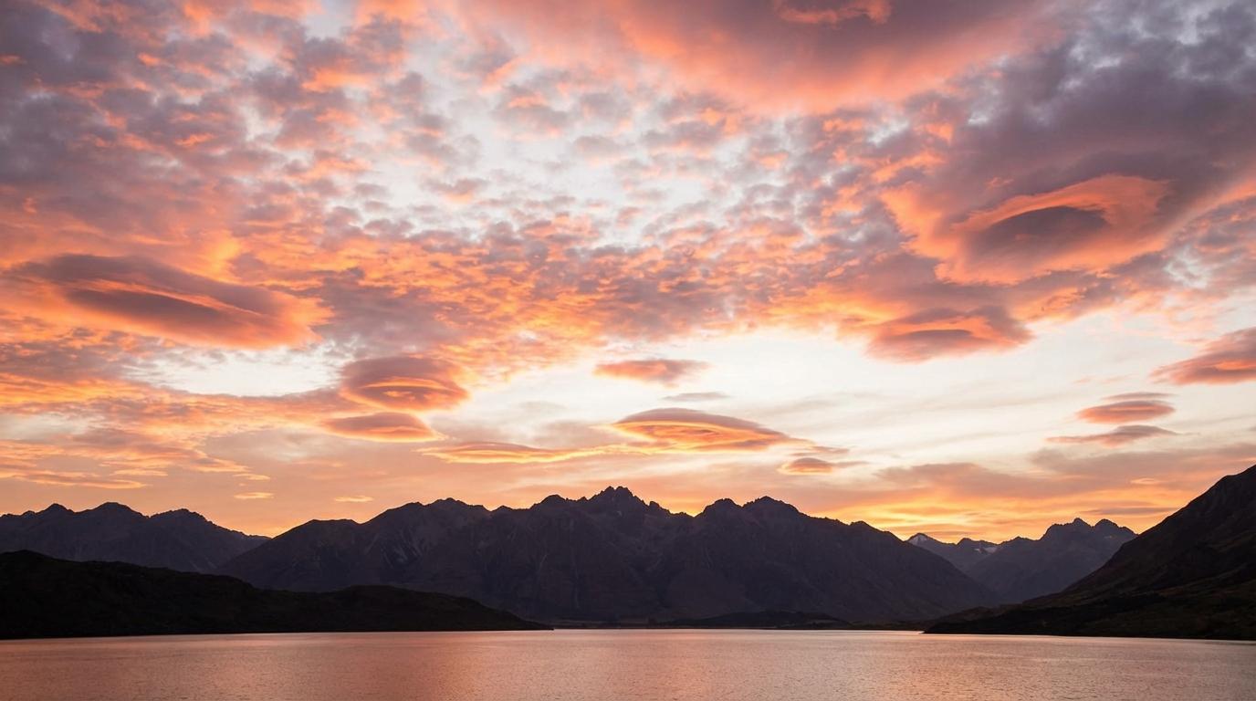
Cirrocumulus lenticularis
© wetterkurs.ch
Description
The name "lenticularis" (Latin: lens-shaped) describes the characteristic smooth, lens- or almond-shaped appearance of this cloud. Cirrocumulus lenticularis are thin, upper-tropospheric clouds that form at great altitudes and consist of ice crystals. They typically form on the lee side of mountain ranges or in strong upper-level winds, when moist air masses are lifted over an obstacle and generate standing wave motions (lee waves). The shape of these clouds is strikingly smooth, sharply defined, and often nearly stationary, as they remain fixed within the wave while air flows through them. They frequently appear individually or in small groups and can create an impressive, almost otherworldly appearance in the sky.
Identification Features
- Lens- or almond-shaped, very smooth and sharply defined cloud patches at great altitude
- Very thin and often translucent, frequently displaying iridescent colors (mother-of-pearl hues)
- Stationary position in the sky despite strong upper-level winds
- Preferentially occur near mountain ranges or in pronounced upper-level airflow
- Noticeably smaller than Altocumulus lenticularis and situated at greater altitude
- Composed of ice crystals and therefore show no sharp shading
- Can appear individually or arranged in rows parallel to the mountain ridge
- Risk of confusion with Altocumulus lenticularis, but considerably higher in altitude and more finely structured
Occurrence by genus
Highlighted: all genera with which lenticularis occurs.
Meteorological Significance
Cirrocumulus lenticularis are a reliable indicator of strong upper-level winds and pronounced wind shear in the upper troposphere. Their presence signals the existence of lee waves or gravity waves, which can be relevant to aviation as they are associated with severe turbulence at high altitudes. Meteorologically, they indicate a dynamically active atmosphere, often in connection with jet streams or approaching frontal systems. They do not produce precipitation on their own, but can serve as a precursor to more unsettled weather when they appear alongside other cloud types. Near mountain ranges, they are a classic sign of föhn conditions.
Facts
- WMO-Code
- Cc len
- Height layer
- High clouds
- Typical height
- 6.0 - 12.0 km
- Genus
- CIRROCUMULUS