Cirrostratus nebulosus
Cs neb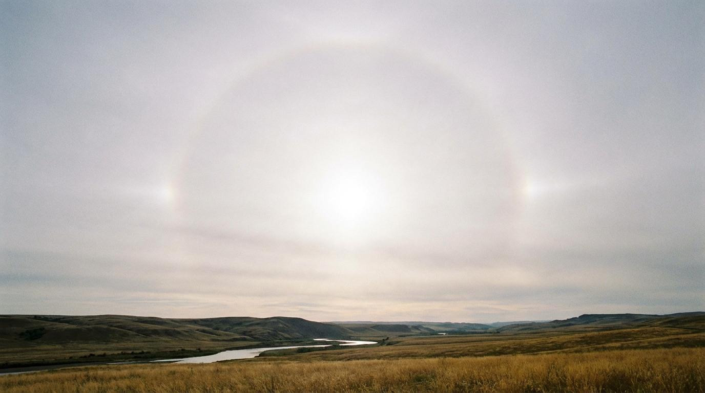
Cirrostratus nebulosus
© wetterkurs.ch
Description
The name "nebulosus" (Latin: nebulous, veiled) describes the uniformly veil-like appearance of this cloud, in which no individual structures or elements are discernible. Cirrostratus nebulosus forms a homogeneous, translucent ice veil high in the sky, which can cover the entire visible area of the sky. The cloud is so thin and uniform that it often only becomes noticeable through the typical halo phenomenon around the sun or moon — a ring of light with a radius of 22 degrees. In contrast to Cirrostratus fibratus, the nebulosus variety shows no fibrous or streaked structure whatsoever, but instead appears as a milky-white veil. It consists entirely of ice crystals and frequently forms through large-scale, slow gliding of warm, moist air masses over a cold air mass.
Identification Features
- Uniform, structureless ice cloud veil with no discernible fibers or bands
- Sky appears milky-white or slightly bluish and hazy
- Sun or moon shine through, but their edges appear blurred
- Frequent occurrence of a 22-degree halo around the sun or moon
- No individual cloud elements or clumps visible
- Shadows on the ground are still visible, but noticeably weakened
- Can easily be confused with thin Altostratus, however Cirrostratus nebulosus is thinner and displays halo phenomena
- Blue sky often still faintly shimmers through the veil
Occurrence by genus
Highlighted: all genera with which nebulosus occurs.
Meteorological Significance
Cirrostratus nebulosus is a classic harbinger of an approaching warm front system and frequently indicates precipitation within the next 12 to 36 hours. The cloud forms through large-scale gliding of warm air over a retreating cold air mass at several kilometres altitude. In a typical frontal sequence, Cirrostratus nebulosus is followed by a thickening into Altostratus and finally into Nimbostratus, with the onset of rain or snow. In some cases, however, the veil may also dissipate without a subsequent frontal passage, for example if the front weakens or is deflected. The appearance of a halo combined with a progressive thickening of the veil is a particularly reliable sign of impending deterioration in weather conditions.
| Genera: | Altocumulus AcAltostratus AsCirrocumulus CcCirrostratus CsCirrus CiCumulonimbus CbCumulus CuNimbostratus NsStratocumulus ScStratus St |
| Species: | fibratus Cs fibnebulosus Cs neb |
Facts
- WMO-Code
- Cs neb
- Height layer
- High clouds
- Typical height
- 5.0 - 13.0 km
- Genus
- CIRROSTRATUS