Altocumulus volutus
Ac vol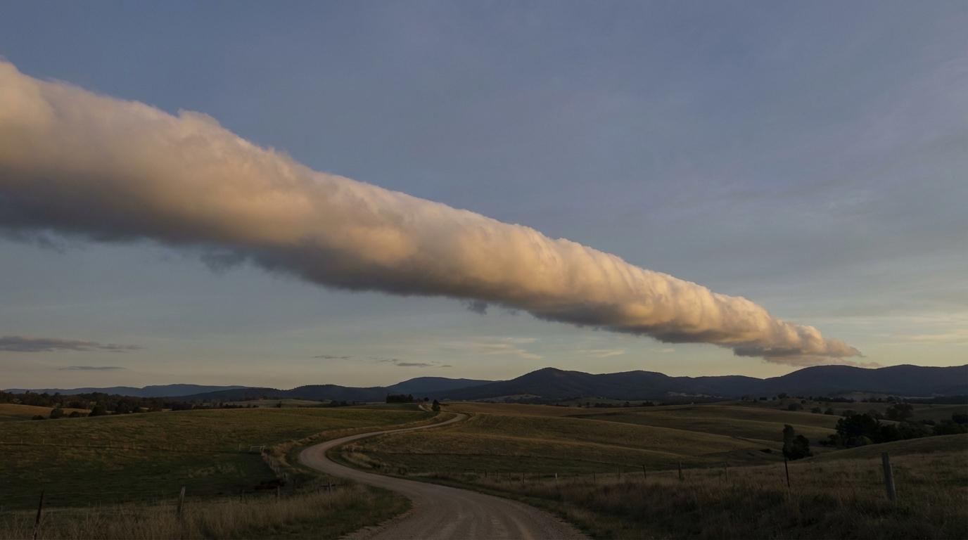
Altocumulus volutus
© wetterkurs.ch
Description
The name "volutus" (Latin: rolled) describes an elongated, tube-shaped cloud that appears to rotate around a horizontal axis. Altocumulus volutus is a relatively rare cloud form at mid-level altitude, known as a roll cloud. It appears as a single, elongated cylinder in the sky that has completely detached from the surrounding cloud field and seems to move slowly. This cloud form typically develops through wind shear or outflow at boundaries between different air masses in the middle troposphere. Altocumulus volutus was officially added to the WMO International Cloud Atlas in 2017, making it one of the more recently recognised cloud classifications.
Identification Features
- Elongated, tube- or cylinder-shaped cloud at mid-level altitude
- Appears to rotate slowly around a horizontal axis
- Completely detached from other cloud layers, floating freely
- Often extends across the entire visible horizon
- No connection to a thunderstorm cell or gust front (distinction from Arcus)
- Usually appears as a single, isolated cylinder
- Typical altitude between 2,000 and 6,000 metres
- Can maintain its shape for an extended period before dissipating
Occurrence by genus
Highlighted: all genera with which volutus occurs.
Meteorological Significance
Altocumulus volutus indicates pronounced wind shear or the meeting of different air masses in the middle troposphere. Unlike the lower-level Arcus cloud (roll cloud), Altocumulus volutus is generally not directly associated with thunderstorms or severe weather events. However, its occurrence can indicate dynamic instabilities and turbulence in the middle atmosphere. It signals that different wind speeds or wind directions prevail at various altitude layers. For aviation, it serves as an indicator of possible turbulence zones at mid-level flight altitudes.
Facts
- WMO-Code
- Ac vol
- Height layer
- Mid-level clouds
- Typical height
- 2.0 - 6.0 km
- Genus
- ALTOCUMULUS