Cumulonimbus capillatus
Cb cap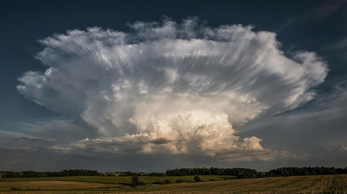
Cumulonimbus capillatus
© wetterkurs.ch
Description
The name "capillatus" (Latin: hairy) describes the characteristic fibrous or hair-like appearance of the upper part of the cloud, which is caused by the presence of ice crystals. Cumulonimbus capillatus is the fully developed form of the thunderstorm cloud, whose upper boundary can reach or even penetrate the tropopause. The top of the cloud frequently spreads out into a distinctive anvil (incus), but can also appear in a disorganized, fibrous manner. This massive cloud extends vertically throughout the entire troposphere and can reach heights of over 12,000 meters. Extreme updrafts and downdrafts prevail within the cloud, which can cause hail, heavy rain, gusts, and electrical discharges.
Identification Features
- Massive, strongly vertically developed cloud towers with a distinctly fibrous or streaky top
- Cloud top consists of ice crystals and appears hairy, fibrous, or silky-lustrous
- Frequently a pronounced anvil (incus) that extends far in the direction of the wind
- Extremely dark, threatening cloud base, often with visible precipitation veils
- Lightning and thunder activity is a clear identifying feature
- Base can appear very dark to almost black, sometimes with gust rolls (arcus)
- Mammatus structures can occur on the underside of the anvil
- Clear distinction from Cb calvus: the top is no longer smooth or cauliflower-like, but dissolves into fibrous strands
Occurrence by genus
Highlighted: all genera with which capillatus occurs.
Meteorological Significance
Cumulonimbus capillatus is the most active and dangerous cloud form and indicates a fully developed thunderstorm. It brings intense precipitation in the form of heavy rain, hail, and graupel, as well as severe wind gusts and downdrafts (downbursts). Lightning and thunder activity is almost always present, and in severe cases, tornadoes can develop. The cloud often marks the peak of convective development and can be associated with cold fronts, squall lines, or local overheating. After the passage of a cumulonimbus capillatus, a marked cooling and rapid weather calming frequently follows.
| Genera: | Altocumulus AcAltostratus AsCirrocumulus CcCirrostratus CsCirrus CiCumulonimbus CbCumulus CuNimbostratus NsStratocumulus ScStratus St |
| Species: | calvus Cb calcapillatus Cb cap |
Facts
- WMO-Code
- Cb cap
- Height layer
- Vertical clouds
- Typical height
- 0.3 - 2.0 km
- Genus
- CUMULONIMBUS