Cumulus mediocris
Cu med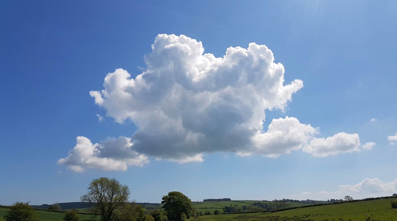
Cumulus mediocris
© Wetterkurs.ch
Description
The name "mediocris" (Latin: moderate, medium-sized) describes a cumulus cloud of moderate vertical extent that appears clearly taller than it is wide, placing it between the flat Cumulus humilis and the towering Cumulus congestus. The top already shows slight turrets and rounded swellings, but does not yet have the cauliflower-like, sharply defined contours characteristic of Cumulus congestus. The cloud typically forms during the course of the day through increasing convective heating and represents a transitional stage in cumulus development. Cumulus mediocris occurs preferentially in the afternoon hours and can, given sufficient moisture and instability, continue to develop into Cumulus congestus or even Cumulonimbus. The base is usually flat and sharply defined, while the top appears bright and luminously white.
Identification Features
- Moderate vertical extent: the cloud is approximately as tall as it is wide, or slightly taller than wide
- Flat, well-defined and often dark base
- Rounded, white swellings at the top, but without a pronounced cauliflower-like structure
- Clearly larger and more vertically developed than Cumulus humilis, but less imposing than Cumulus congestus
- Sharp contours at the top, no fibrous or ragged edges
- Frequently appears from late morning onward and continues to develop throughout the day
- Can cast small shadows on the ground
- Often occurs in groups with varying stages of development
Occurrence by genus
Highlighted: all genera with which mediocris occurs.
Meteorological Significance
Cumulus mediocris indicates increasing atmospheric instability and growing convection. Its appearance suggests that thermals are becoming more vigorous and that the atmosphere contains sufficient moisture for further vertical cloud development. With continued heating and adequate instability, Cumulus mediocris can develop into Cumulus congestus and ultimately into Cumulonimbus, which may result in local showers or thunderstorms. If development stalls at this stage, dry weather with intermittent cloud cover can generally be expected. Cumulus mediocris alone does not typically produce precipitation, but is considered an early indicator of possible convective precipitation later in the day.
Facts
- WMO-Code
- Cu med
- Height layer
- Vertical clouds
- Typical height
- 0.6 - 2.0 km
- Genus
- CUMULUS