Altocumulus lenticularis
Ac len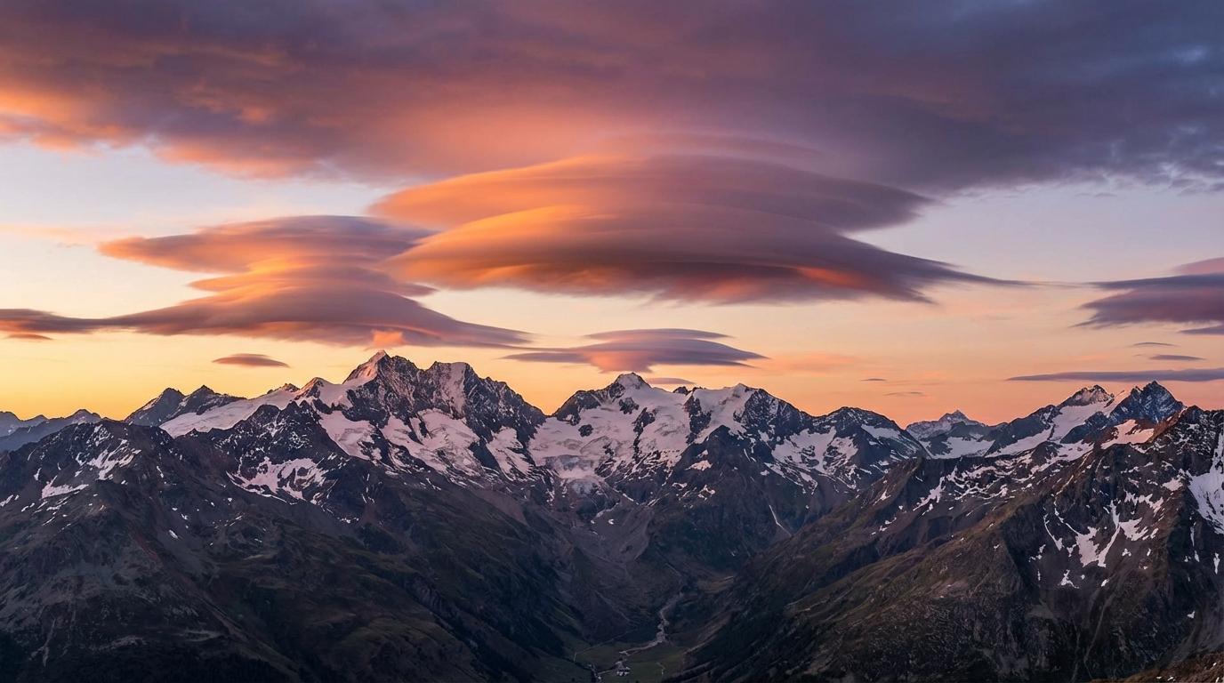
Altocumulus lenticularis
© Wetterkurs.ch
Description
The name "lenticularis" (Latin: lens-shaped) describes the characteristic, smoothly sculpted form of this cloud, which resembles an optical lens or a flying saucer. Altocumulus lenticularis are stationary clouds that typically form on the lee side of mountain ranges or hill chains when moist air flows over an obstacle and is set into oscillation (so-called lee waves). The clouds form at the wave crest, where air rises and cools, and dissipate on the descending side, causing them to appear motionless in the sky despite strong upper-level winds. Their surface is often remarkably smooth and sharply defined, sometimes displaying iridescent colours. They can occur individually or in multiple layers stacked on top of one another, occasionally referred to as "pile d'assiettes" (stack of plates).
Identification Features
- Distinctive lens- or almond-shaped form with smooth, sharply defined edges
- Cloud remains stationary despite strong upper-level winds
- Occurs preferentially near mountain ranges and hill chains (lee waves)
- Surface appears smooth and polished, often with a silky sheen
- Can appear in multiple layers stacked on top of one another
- Iridescence (shimmering rainbow colours) frequently visible at the edges
- Distinguished from ordinary altocumulus by its isolated, symmetrical shape
- Occasionally mistaken for UFOs
Occurrence by genus
Highlighted: all genera with which lenticularis occurs.
Meteorological Significance
Altocumulus lenticularis are an important indicator of strong upper-level winds and wave motion in the atmosphere. Their presence signals foehn conditions near mountains and can indicate a change in the large-scale weather pattern, particularly when a frontal system is approaching. For aviation, they are of great significance as they point to strong turbulence, rotors, and dangerous updrafts and downdrafts in the vicinity of mountains. Glider pilots, on the other hand, deliberately make use of the associated lee waves to reach extreme altitudes. The clouds themselves generally do not produce precipitation, but can serve as a harbinger of a change in weather within the next 12 to 24 hours.
Facts
- WMO-Code
- Ac len
- Height layer
- Mid-level clouds
- Typical height
- 2.0 - 6.0 km
- Genus
- ALTOCUMULUS