Stratocumulus castellanus
Sc cas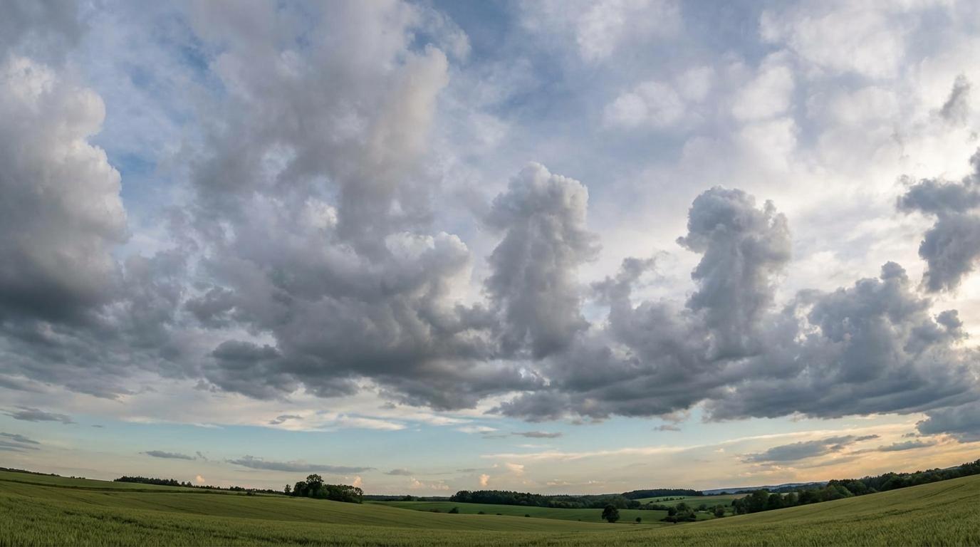
Stratocumulus castellanus
© Wetterkurs.ch
Description
The name "castellanus" (Latin: castle-like, from castellum = small castle) describes clouds that display tower- or battlement-like protrusions rising from a common base. Stratocumulus castellanus consists of a layer of stratocumulus clouds from whose upper surface cumuliform, tower-like elevations grow upward. These turrets are generally taller than they are wide, giving the cloud layer a distinctive, battlemented profile. The cloud forms when pronounced convective instability exists at the level of the stratocumulus layer, causing local updrafts to push the cloud tops upward. Stratocumulus castellanus is a clear sign of unstable air layering in the lower troposphere and can be a precursor to more vigorous convective developments.
Identification Features
- Stratocumulus layer with clearly visible, tower-like protrusions at the top
- The turrets are typically taller than they are wide and resemble battlements
- Common, continuous cloud base from which the convective towers grow
- Usually gray to dark gray in color, with the turrets appearing brighter on the sun-facing side
- Distinguished from Altocumulus castellanus by its significantly lower cloud base
- The battlement-like structures are often arranged in rows or groups
- The shadows cast by the turrets onto the surrounding cloud layer can be a helpful identification feature
- Typically observed in the morning or early afternoon during increasing atmospheric instability
Occurrence by genus
Highlighted: all genera with which castellanus occurs.
Meteorological Significance
Stratocumulus castellanus is an important indicator of convective instability in the lower layers of the troposphere. The appearance of this cloud form signals that sufficient moisture and instability are present to trigger vertical convection within the cloud layer. Stratocumulus castellanus is frequently a precursor to stronger convective developments, which can grow into Cumulus congestus or even Cumulonimbus as the day progresses. Particularly during the summer months, the morning appearance of this cloud type can indicate an increased risk of thunderstorms in the afternoon. In many cases, the stratocumulus layer dissipates during the course of the day and is replaced by well-developed convective clouds.
Facts
- WMO-Code
- Sc cas
- Height layer
- Low clouds
- Typical height
- 0.6 - 2.0 km
- Genus
- STRATOCUMULUS