Altocumulus duplicatus
Ac du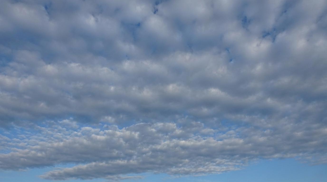
Altocumulus duplicatus
© wetterkurs.ch
Description
The name "duplicatus" (Latin: doubled, duplicate) describes a cloud variety in which two or more layers of altocumulus are stacked at slightly different altitudes. These layers may partially merge with one another or remain clearly separated, sometimes delineated by thin gaps between them. The individual layers typically consist of small, rounded cloud elements arranged in bands or fields. Altocumulus duplicatus commonly forms at boundaries between air masses of differing temperature and humidity, and indicates a complex vertical layering of the middle troposphere. The appearance is often particularly striking, as the overlapping layers create a three-dimensional, multi-layered sky through varying illumination and transparency.
Identification Features
- Two or more clearly distinguishable altocumulus layers stacked in the sky
- The individual layers are located at slightly different altitudes
- Thin gaps or spaces between the layers are sometimes visible
- Cloud elements within each layer may differ in size or density
- Layers may partially overlap, causing the sky to appear denser in places
- When viewed at an oblique angle, the cloud cover appears particularly multi-layered and complex
- The different layers may move at varying speeds or in different directions
Occurrence by genus
Highlighted: all genera with which duplicatus occurs.
Meteorological Significance
Altocumulus duplicatus indicates a pronounced layering in the middle troposphere, where air masses with differing properties are sliding over one another. This configuration frequently occurs ahead of frontal zones and may serve as an early sign of an approaching deterioration in weather conditions. As the layers increase in thickness and density, the likelihood of precipitation within the following 12 to 24 hours rises. Differing directions of movement among the individual layers point to wind shear, which is of relevance to aviation. In stable weather patterns, however, altocumulus duplicatus may also occur without subsequent precipitation and dissipate without further development.
Facts
- WMO-Code
- Ac du
- Height layer
- Mid-level clouds
- Typical height
- 2.0 - 6.0 km
- Genus
- ALTOCUMULUS