Altostratus duplicatus
As du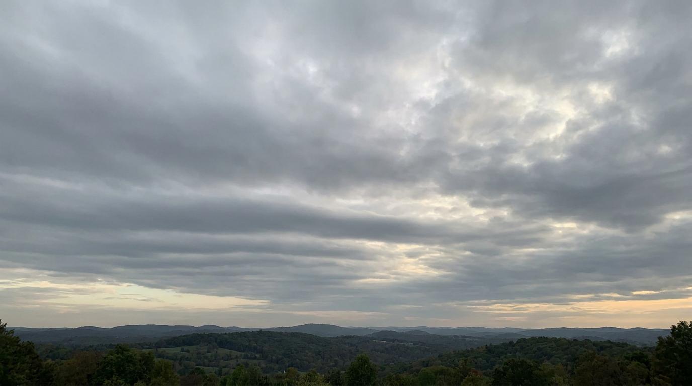
Altostratus duplicatus
© wetterkurs.ch
Description
The name "duplicatus" (Latin: doubled, duplicate) describes a variety in which altostratus occurs in at least two superimposed layers. These layers may partially merge with one another or be separated by narrow gaps, so that in places the upper or lower layer becomes separately distinguishable. Altostratus duplicatus appears as an extensive, grey to bluish veil of cloud that allows the sun to shine through only diffusely and covers the sky over large areas. The double-layered structure commonly forms through differing flow conditions at various altitudes, where air masses with slightly different temperatures and humidity levels glide over one another. This cloud form is a typical sign of complex atmospheric layering in the middle level of the troposphere.
Identification Features
- Two or more superimposed, partially separated altostratus layers are discernible
- An extensive, grey to bluish-grey veil of cloud covering most of the sky
- The sun shines through only faintly and diffusely, as if through frosted glass
- Where gaps exist between the layers, different shades of grey or differences in brightness are visible
- The individual layers may move at different speeds or in different directions
- No distinctly structured base, but rather uniform and diffuse in appearance
- Distinction from simple altostratus by observing the layering at edges or zones of partial clearance
Occurrence by genus
Highlighted: all genera with which duplicatus occurs.
Meteorological Significance
Altostratus duplicatus indicates a pronounced layering of the middle troposphere, in which moist air masses are present at several levels. This cloud form frequently occurs ahead of warm or occlusion fronts and signals an increasing accumulation of moisture in the atmosphere. There is a high probability that persistent, steady precipitation will follow within the next few hours. The multi-layered structure may also indicate a strengthening of upward vertical motion, which further increases the likelihood of precipitation. In combination with falling air pressure, altostratus duplicatus is a reliable harbinger of an approaching deterioration in weather conditions.
Facts
- WMO-Code
- As du
- Height layer
- Mid-level clouds
- Typical height
- 2.0 - 6.0 km
- Genus
- ALTOSTRATUS