Altocumulus perlucidus
Ac pe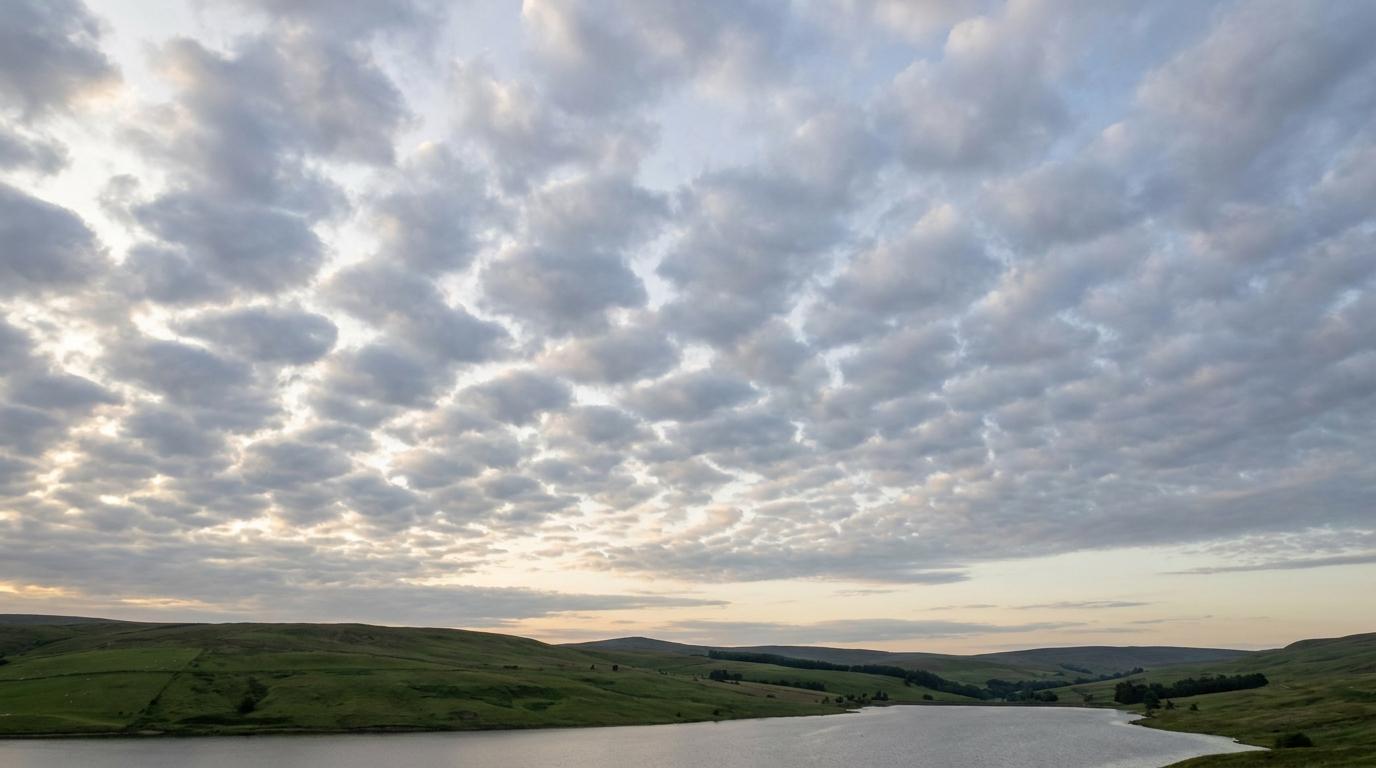
Altocumulus perlucidus
© wetterkurs.ch
Description
The name "perlucidus" (Latin: translucent) describes a variety of altocumulus in which distinct gaps exist between individual cloud elements, through which the blue sky or higher cloud layers become visible. The cloud cover consists of numerous rounded masses or patches arranged in an extensive layer, with the spaces between them allowing light to shine through. Altocumulus perlucidus frequently occurs in stable air masses and can cover large portions of the sky without completely obscuring it. The individual cloud elements are often regularly arranged and create an impressive, mosaic-like pattern across the sky.
Identification Features
- Extensive layer of individual cloud masses or patches at mid-level altitude
- Clearly visible gaps between cloud elements through which blue sky is apparent
- Cloud elements are typically white to grey in colour
- Regular, mosaic- or checkerboard-like arrangement of elements
- Individual elements have an apparent width of approximately 1 to 5 degrees in the sky
- Unlike Altocumulus opacus, the sun or moon can be seen through the gaps
- Distinction from Cirrocumulus: Altocumulus elements appear larger and occur at lower altitudes
Occurrence by genus
Highlighted: all genera with which perlucidus occurs.
Meteorological Significance
Altocumulus perlucidus generally indicates a relatively stable atmosphere at mid-level altitudes and is often associated with calm weather. However, when it appears in the morning during humid and muggy conditions, it can signal the development of thunderstorms later in the day. An increase in cloud density, in which the gaps gradually close (transitioning to opacus), can indicate an approaching weather change with precipitation. In association with a warm front, Altocumulus perlucidus can be a precursor to altostratus and subsequent prolonged rainfall. When occurring in isolation, it is generally of little meteorological significance.
Facts
- WMO-Code
- Ac pe
- Height layer
- Mid-level clouds
- Typical height
- 2.0 - 6.0 km
- Genus
- ALTOCUMULUS