Cumulus radiatus
Cu ra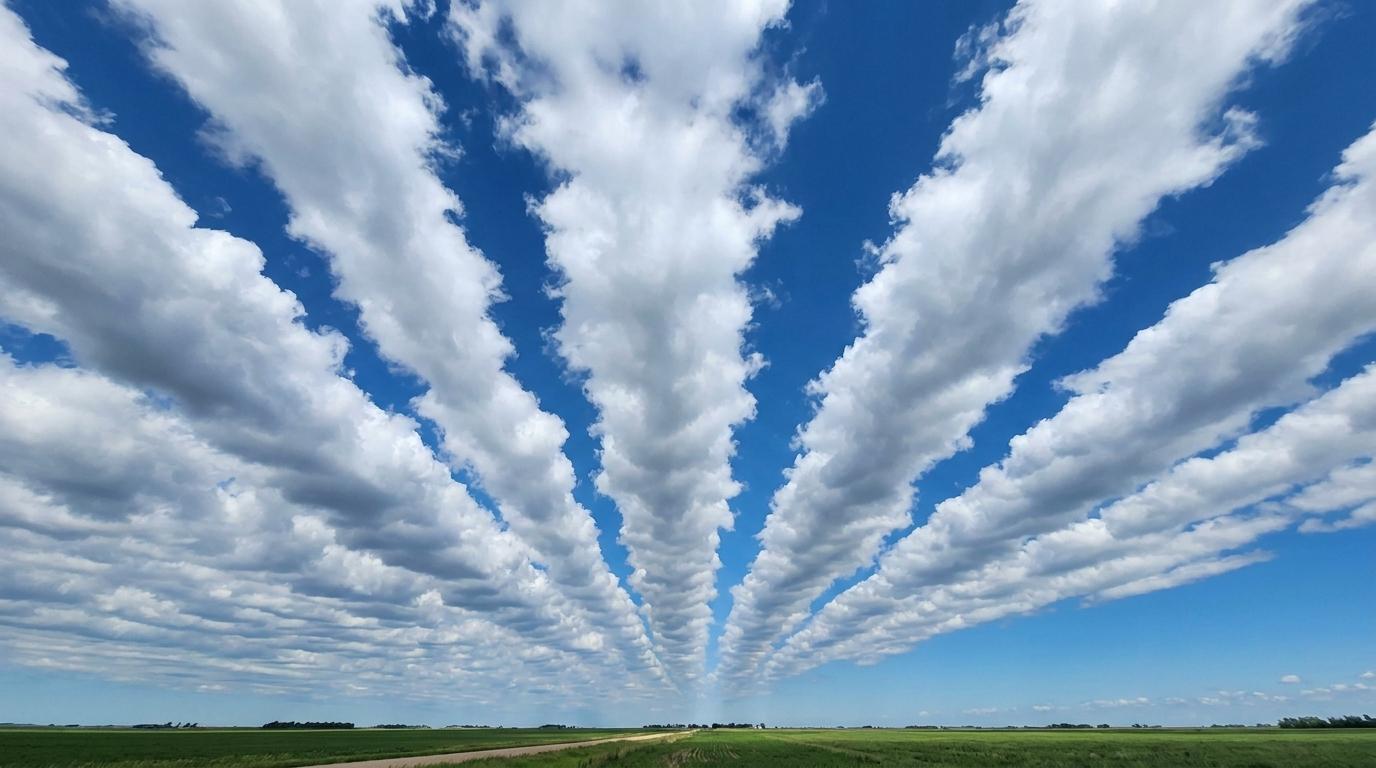
Cumulus radiatus
© wetterkurs.ch
Description
The name "radiatus" (Latin: radiating) describes the apparent arrangement of these cumulus clouds in parallel rows or bands, which, due to the effect of perspective, seem to converge toward a common point on the horizon. This arrangement is typically caused by a uniform wind flow in the lower troposphere, which organises convective cells at regular intervals along the wind direction. Cumulus radiatus is also referred to as "cloud streets" and can be observed across vast stretches of the sky. The individual cumulus clouds may display varying stages of development, ranging from shallow humilis forms to more developed mediocris forms. This variety is particularly impressive when thermal activity is uniform over homogeneous terrain or over the sea.
Identification Features
- Cumulus clouds arranged in clearly distinguishable parallel rows or bands
- The rows appear to converge perspectively toward one or two points on the horizon
- The cloud rows align with the wind direction in the lower troposphere
- Clear, cloud-free strips are present between the rows
- Individual cloud elements display the typical cumulus shape with a flat base and domed top
- The effect is most visible when looking along or against the wind direction
- The spacing between the rows is relatively uniform
- Occurs preferentially during well-organised convection and uniform airflow
Occurrence by genus
Highlighted: all genera with which radiatus occurs.
Meteorological Significance
Cumulus radiatus indicates a well-organised convective boundary layer with uniform wind shear and regular thermal activity. The cloud streets suggest a stable layer above the convection zone that limits vertical growth. The wind direction in the lower troposphere can be read directly from the orientation of the cloud rows. As long as the clouds remain shallow, dry and pleasant weather is to be expected. However, if instability increases, the individual cumulus clouds may develop further vertically, which can indicate the possible formation of showers or thunderstorms later in the day.
Facts
- WMO-Code
- Cu ra
- Height layer
- Vertical clouds
- Typical height
- 0.6 - 2.0 km
- Genus
- CUMULUS