Cirrocumulus undulatus
Cc un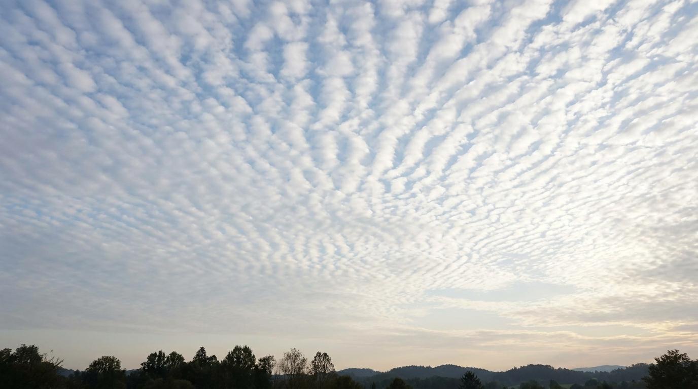
Cirrocumulus undulatus
© wetterkurs.ch
Description
The name "undulatus" (Latin: wave-shaped) describes a variety of cirrocumulus in which the fine cloud elements are arranged in regular, parallel wave patterns. These delicate, high-altitude clouds consist exclusively of ice crystals and form an impressive, ribbed or undulating pattern in the sky. The wave structure is created by gravity waves or wind shear at great altitude, where air layers moving at different speeds or temperatures pass over one another. Cirrocumulus undulatus appears as a thin, translucent cloud layer through which sunlight can usually pass without difficulty. The regular wave structure clearly distinguishes this variety from other cirrocumulus forms and gives the sky an aesthetically pleasing, almost woven appearance.
Identification Features
- Very high, fine cloud elements arranged in a regular, wave-shaped pattern
- Parallel wave bands or ripple patterns across the sky
- Individual cloud elements are small, with an apparent width of less than 1° (smaller than a finger held at arm's length)
- Translucent to nearly transparent, sunlight passes through easily
- Composed of ice crystals, therefore appearing white and silky
- Occurs at altitudes of approximately 6,000 to 12,000 metres
- Distinguished from altocumulus undulatus by its noticeably smaller cloud elements
- May produce iridescence or a corona effect around the sun or moon
Occurrence by genus
Highlighted: all genera with which undulatus occurs.
Meteorological Significance
Cirrocumulus undulatus indicates wind shear and wave activity in the upper troposphere, pointing to a degree of atmospheric instability at high altitude. The appearance of these clouds can be a precursor to an approaching warm front or a general deterioration in weather within the next 12 to 24 hours. In combination with increasing cirrostratus, this may signal approaching precipitation. When occurring in isolation, however, they often have no immediate significance for surface weather conditions, and fair weather tends to persist in the short term. For aviation, the associated high-altitude turbulence (clear air turbulence) is of particular relevance.
Facts
- WMO-Code
- Cc un
- Height layer
- High clouds
- Typical height
- 6.0 - 12.0 km
- Genus
- CIRROCUMULUS