Altostratus radiatus
As ra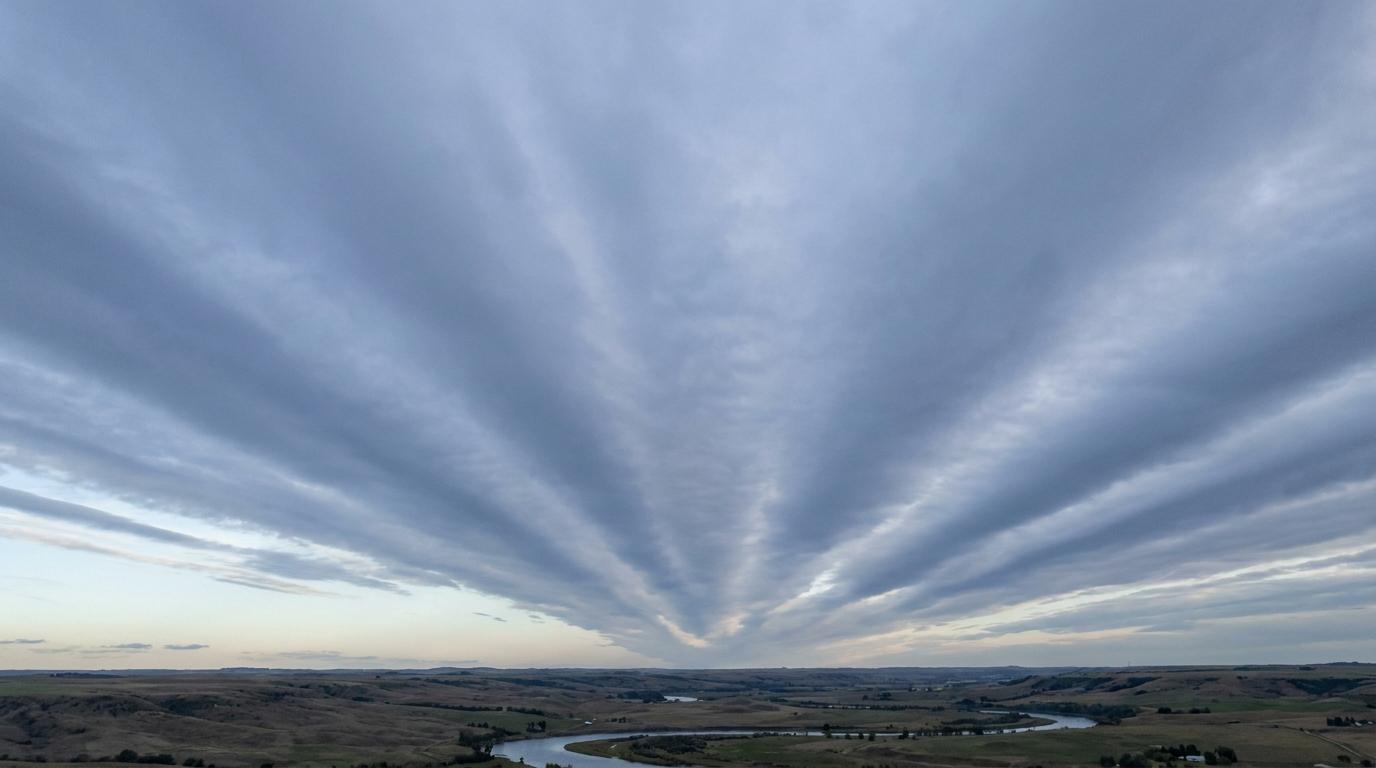
Altostratus radiatus
© wetterkurs.ch
Description
The name "radiatus" (Latin: radiated, ray-like) describes a variety of altostratus in which the cloud elements are arranged in long, parallel bands or streaks that appear to converge toward a single point on the horizon due to perspective. Altostratus radiatus forms an extensive, grey-layered cloud cover at mid-level altitude, traversed by distinctive streak-like structures. These streaks are produced by wind shear or undulating air movements in the middle troposphere, which align the cloud material in a preferred direction. The cloud may partially or completely obscure the sun, though it typically still shines through as a diffusely glowing disc, similar to frosted glass. In contrast to other forms of altostratus, the parallel band structure is the most striking visual feature.
Identification Features
- Extensive grey to grey-blue cloud layer at mid-level altitude
- Clearly recognisable parallel bands or streaks that appear to converge toward a single point on the horizon
- The sun typically still shines diffusely through the cloud layer (as if through frosted glass)
- No halo phenomena, as the cloud consists of water droplets or mixed-phase particles
- The streak structure persists over an extended period and is visible across a large area
- Can cover the entire sky, with the band structure distinguishing this cloud from ordinary altostratus
- The parallel bands typically run in the direction of the upper-level wind
Occurrence by genus
Highlighted: all genera with which radiatus occurs.
Meteorological Significance
Altostratus radiatus is often an indicator of an approaching warm front or an extensive precipitation area. The parallel band structure points to pronounced wind shear in the middle troposphere, signalling dynamic processes within the atmosphere. If the cloud layer thickens progressively and its base lowers, the onset of precipitation — often persistent — can be expected within the next 6 to 12 hours. Should the altostratus radiatus transition into nimbostratus, prolonged rain or continuous snowfall typically follows. Under stable conditions, however, the cloud may also dissipate without producing any significant precipitation.
Facts
- WMO-Code
- As ra
- Height layer
- Mid-level clouds
- Typical height
- 2.0 - 6.0 km
- Genus
- ALTOSTRATUS