Altostratus translucidus
As tr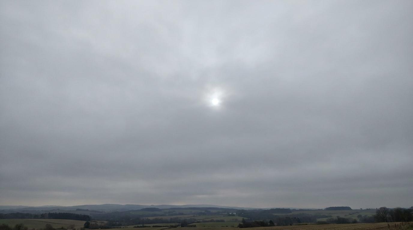
Altostratus translucidus
© wetterkurs.ch
Description
The name "translucidus" (Latin: translucent) describes a variety of altostratus through which the sun or moon is still faintly visible, as if shining through frosted glass. Altostratus translucidus forms an extensive, gray to bluish-gray cloud layer at mid-levels that covers large areas of the sky, while still allowing enough light through to cast shadows on the ground. The cloud consists of a mixture of water droplets and ice crystals. In contrast to the denser altostratus opacus, the layer is thin enough that the position of the sun or moon remains visible as a bright, diffuse brightening, even though no sharp outlines can be seen. This cloud form frequently occurs in warm front systems and can develop over time into a denser altostratus opacus.
Identification Features
- Extensive, uniform cloud layer at mid-level altitude, covering large areas of the sky
- Sun or moon shines through diffusely, similar to frosted glass
- No halo phenomena (unlike cirrostratus)
- Gray to bluish-gray coloration of the cloud layer
- Faint shadows are still discernible on the ground
- No clearly defined cloud edges or structures
- More uniform and higher-lying layer than stratus
- Distinction from altostratus opacus: the position of the sun is still recognizable
Occurrence by genus
Highlighted: all genera with which translucidus occurs.
Meteorological Significance
Altostratus translucidus is frequently a harbinger of an approaching warm front and indicates increasing moisture in the mid-troposphere. In the typical frontal sequence, the cloud develops from cirrostratus and subsequently thickens into altostratus opacus and finally into nimbostratus with persistent precipitation. Light precipitation can already fall from altostratus translucidus, but at mid-level altitude it often does not reach the ground (virga). The thickening of the layer within a few hours is a reliable indicator of impending precipitation and a general deterioration in weather conditions. In stable high-pressure situations, however, altostratus translucidus can also occur without further development and dissipate again.
Facts
- WMO-Code
- As tr
- Height layer
- Mid-level clouds
- Typical height
- 2.0 - 6.0 km
- Genus
- ALTOSTRATUS