Altostratus undulatus
As un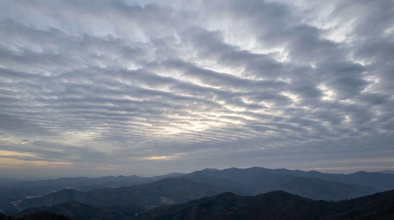
Altostratus undulatus
© wetterkurs.ch
Description
The name "undulatus" (Latin: wave-shaped) describes a variety of altostratus in which the cloud layer displays a distinct wave pattern. These wave-like structures are caused by wind shear at the boundary between two air layers moving at different speeds or directions, a phenomenon known as Kelvin-Helmholtz instability. Altostratus undulatus appears as an extensive, grey-whitish to bluish cloud layer with parallel waves or streaks. The sun may shine through the cloud, but appears veiled as if through frosted glass, without casting sharp shadows on the ground. Occasionally, the wave crests may be thinner than the troughs, creating an alternating pattern of lighter and darker areas.
Identification Features
- Extensive, uniform cloud layer at mid-level with a recognisable wave pattern
- Parallel streaks or waves extending across large portions of the sky
- Grey-whitish to bluish colouration, often veiling the sun
- Sun shines through as if through frosted glass, no sharp shadows on the ground
- Wave crests appear brighter, wave troughs darker
- Noticeably more uniform structure than altocumulus undulatus, with no individual cloud elements
- The wave bands maintain their orientation over extended periods of time
Occurrence by genus
Highlighted: all genera with which undulatus occurs.
Meteorological Significance
Altostratus undulatus indicates pronounced wind shear in the middle atmospheric layers, suggesting dynamic processes taking place in the atmosphere. This cloud form can develop ahead of an approaching frontal system and is often a sign of deteriorating weather conditions to come. As the cloud layer gradually thickens and lowers, precipitation may begin within 12 to 24 hours. The wave structure can dissolve as moisture increases, transitioning into a uniform, thick altostratus or even nimbostratus. This cloud form is relevant to aviation, as the wind shear can cause turbulence.
Facts
- WMO-Code
- As un
- Height layer
- Mid-level clouds
- Typical height
- 2.0 - 6.0 km
- Genus
- ALTOSTRATUS