Cirrostratus
Cs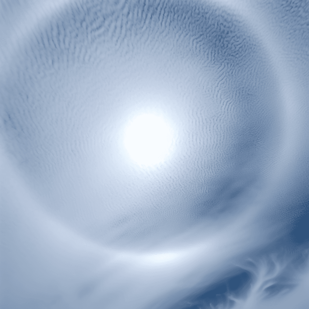
Cirrostratus
© Wetterkurs.ch
Description
Cirrostratus is a high cloud layer composed of ice crystals that partially or completely covers the sky with a thin, veil-like coating. The name combines "cirrus" (Latin: curl of hair) and "stratus" (Latin: spread out), describing an extensive, translucent ice cloud at high altitude. Cirrostratus is often so thin that the sun and moon shine through it, producing characteristic halo phenomena — ring-shaped refraction effects with a radius of 22° or 46°. The cloud can extend across large portions of the sky, giving it a milky-white, diffuse appearance. It typically forms through the large-scale gliding of warm, moist air over a cold air mass and is a classic harbinger of approaching frontal systems.
Identification Features
- Thin, whitish veil covering the entire sky or large portions of it
- The sun and moon remain visible and shine through the cloud
- Halo phenomena are common (ring of light around the sun or moon) with a radius of 22° or 46°
- Objects on the ground generally still cast shadows as long as the layer remains thin
- No distinct structure or individual elements as seen in cirrocumulus
- The edges of the cloud may appear fibrous or smooth
- Can develop from cirrus and gradually thicken
- Distinction from altostratus: cirrostratus produces halos, altostratus does not
Species of this genus
Highlighted: all species that occur with Cirrostratus.
Meteorological Significance
Cirrostratus is one of the most important harbingers of an approaching warm front, signalling that a deterioration in weather can be expected within the next 12 to 24 hours. The cloud indicates large-scale gliding of moist air in the upper troposphere. As the cirrostratus progressively thickens and the cloud base lowers, altostratus and eventually nimbostratus with prolonged precipitation typically follow. In some cases, however, cirrostratus can also occur without subsequent frontal activity — for example, as the remnant of thunderstorm anvils or under stable upper-level flow conditions. The appearance of halo phenomena in cirrostratus is regarded in folk wisdom as a sign of rain, and it does in fact have a high rate of accuracy.
| Genera: | Altocumulus AcAltostratus AsCirrocumulus CcCirrostratus CsCirrus CiCumulonimbus CbCumulus CuNimbostratus NsStratocumulus ScStratus St |
| Subtypes: | fibratus Cs fibnebulosus Cs neb |
Facts
- WMO-Code
- Cs
- Height layer
- High clouds
- Typical height
- 5.0 - 13.0 km
- Genus
- CIRROSTRATUS