Cumulonimbus
Cb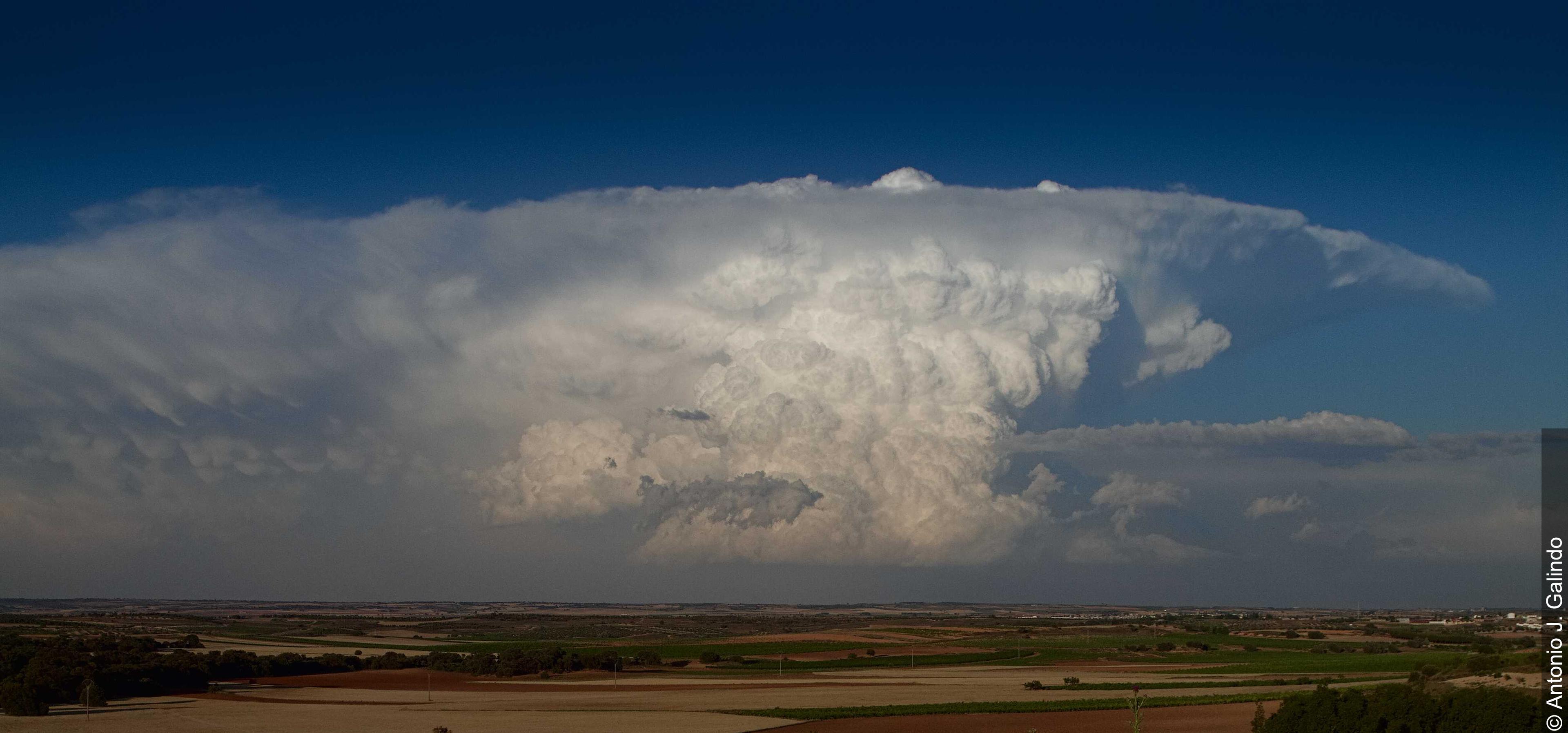
Cumulonimbus
© Antonio J. Galindo
Description
The name Cumulonimbus is derived from the Latin words "cumulus" (heap) and "nimbus" (rain cloud), describing a powerful, vertically extensive heap cloud with intense precipitation activity. The Cumulonimbus is the most imposing of all cloud genera and can extend from the level of low clouds up to the tropopause, reaching vertical extents of over 12 kilometres. It forms through intense convective lifting in an unstable atmosphere and is associated with severe weather phenomena such as heavy rain, hail, storm gusts, and thunderstorms. Characteristic is its anvil-shaped top (Incus), which develops when the rising air spreads out horizontally at the tropopause. The lower part of the cloud often appears dark and threatening, while the upper portion consists of ice crystals and can take on a smooth, fibrous, or streaked appearance.
Identification Features
- Extremely large vertical extent, often towering up to the tropopause
- Characteristic anvil shape (Incus) at the cloud top, spreading out laterally
- Dark, menacing cloud base with visible precipitation curtains
- Frequently accompanied by lightning and thunder
- Severe gusts and sudden wind direction changes near the ground
- Roll-shaped gust clouds (Arcus) may precede the cloud
- Mammatus structures (pouch-like protrusions) on the underside of the anvil
- Clearly visible, boiling and rapidly developing cloud towers
Species of this genus
Highlighted: all species that occur with Cumulonimbus.
Meteorological Significance
The Cumulonimbus is the most significant thunderstorm cloud and represents the most intense convective weather phenomena. It produces heavy precipitation, hail, storm gusts, tornadoes, and electrical discharges in the form of lightning. In tropical regions, it is the primary driver of energy transport in the atmosphere and plays a central role in the global water cycle. The occurrence of Cumulonimbus indicates a strongly unstable atmospheric stratification and calls for particular caution in air and road traffic as well as during outdoor activities. Following the passage of a Cumulonimbus cell, a rapid temperature drop and a temporary period of calmer weather are typically observed.
| Genera: | Altocumulus AcAltostratus AsCirrocumulus CcCirrostratus CsCirrus CiCumulonimbus CbCumulus CuNimbostratus NsStratocumulus ScStratus St |
| Subtypes: | calvus Cb calcapillatus Cb cap |
Facts
- WMO-Code
- Cb
- Height layer
- Vertical clouds
- Typical height
- 0.3 - 2.0 km
- Genus
- CUMULONIMBUS